Nagoya City Green Civil Engineering Bureau — 2026
Urban Infrastructure DX
A unified system for city staff and field contractors — bringing inspection, reporting, and approval workflows for public green infrastructure into one coherent product.
- Role
- Lead Product Designer
- Client
- Nagoya City Green Civil Engineering Bureau
- Year
- 2026
- Services
- Product Design, UI/UX, Design System, Frontend
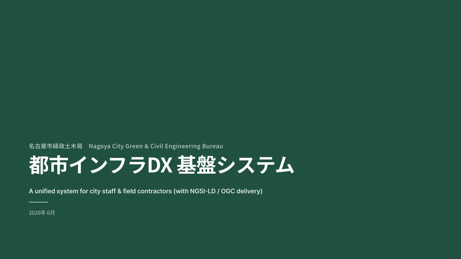
Eukarya prototype deck for the Nagoya City Greenery and Public Works Bureau RFI, showcasing a unified GIS and inspection/maintenance workflow platform for municipal staff and field contractors.
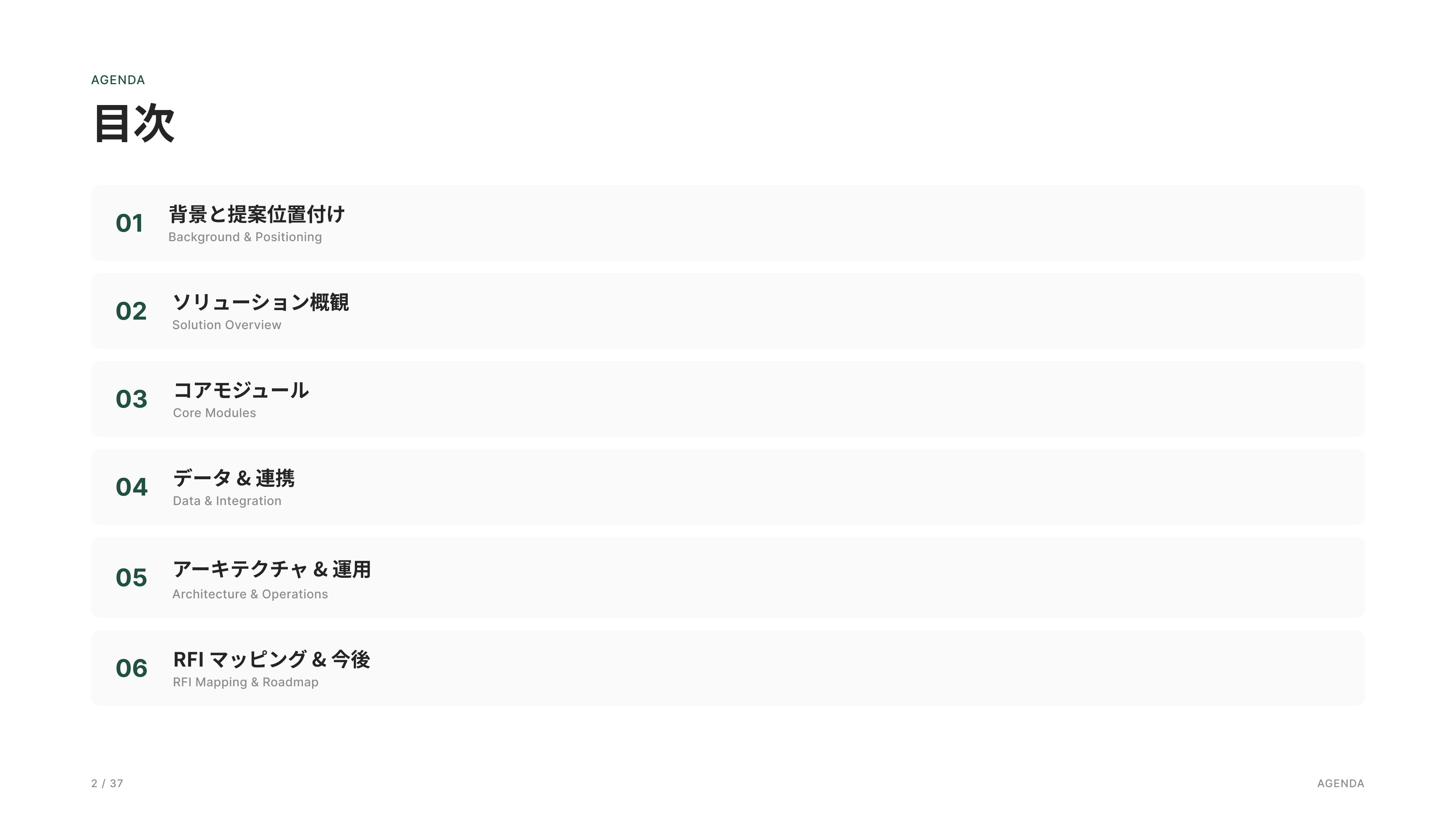
Background & Proposal Context, Solution Overview, Core Modules, Data Integration, Architecture & Operations, RFI Mapping, Roadmap, Appendix, and Executive Brief.
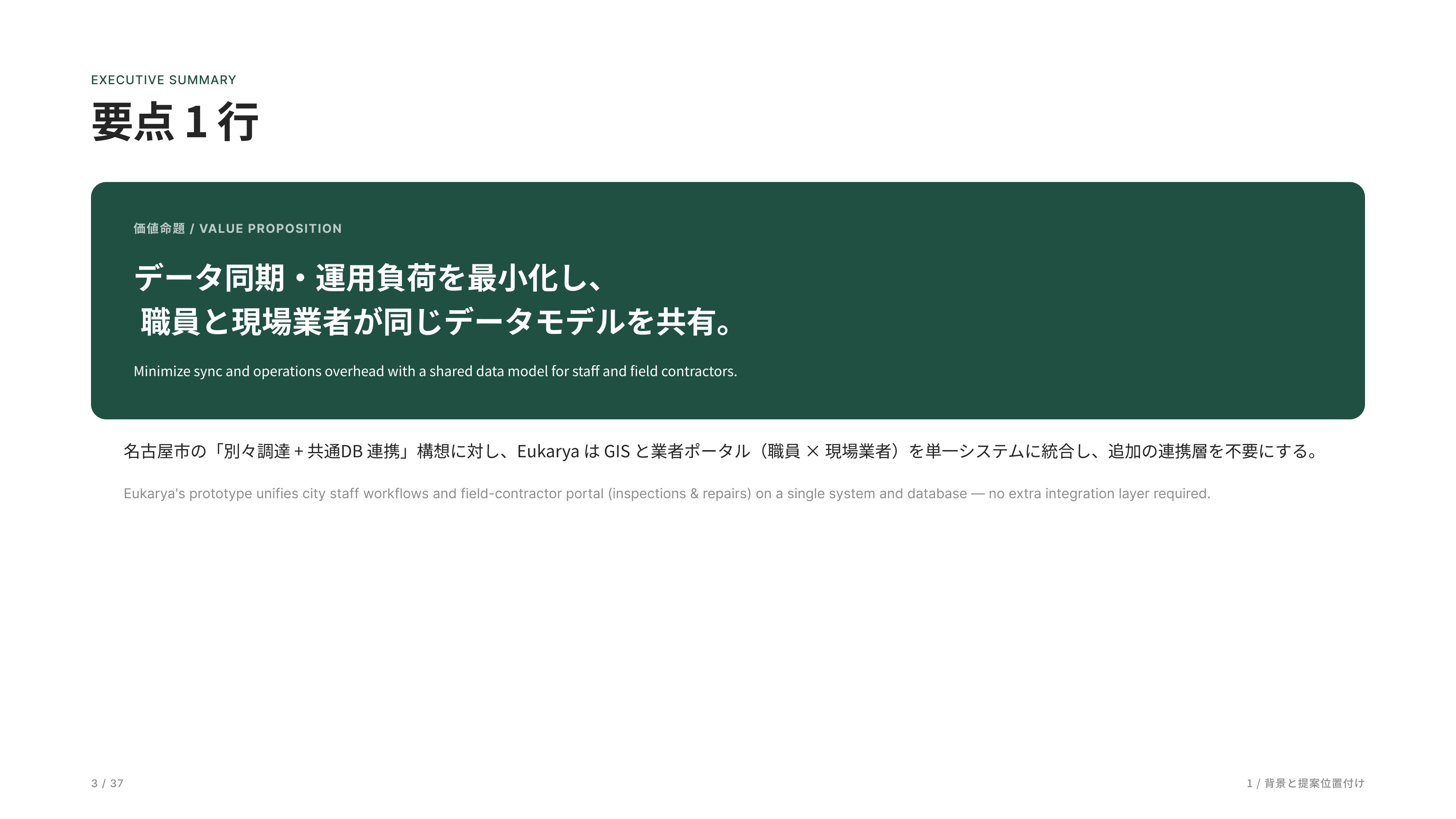
The core of this project is a unified platform that connects municipal staff and field contractors within a single system. Staff manage assets and work orders through GIS-based tools, while contractors perform field inspections and updates via tablets. Both operate on the same database and data model, eliminating the need for integration layers, synchronization processes, or data consistency monitoring.
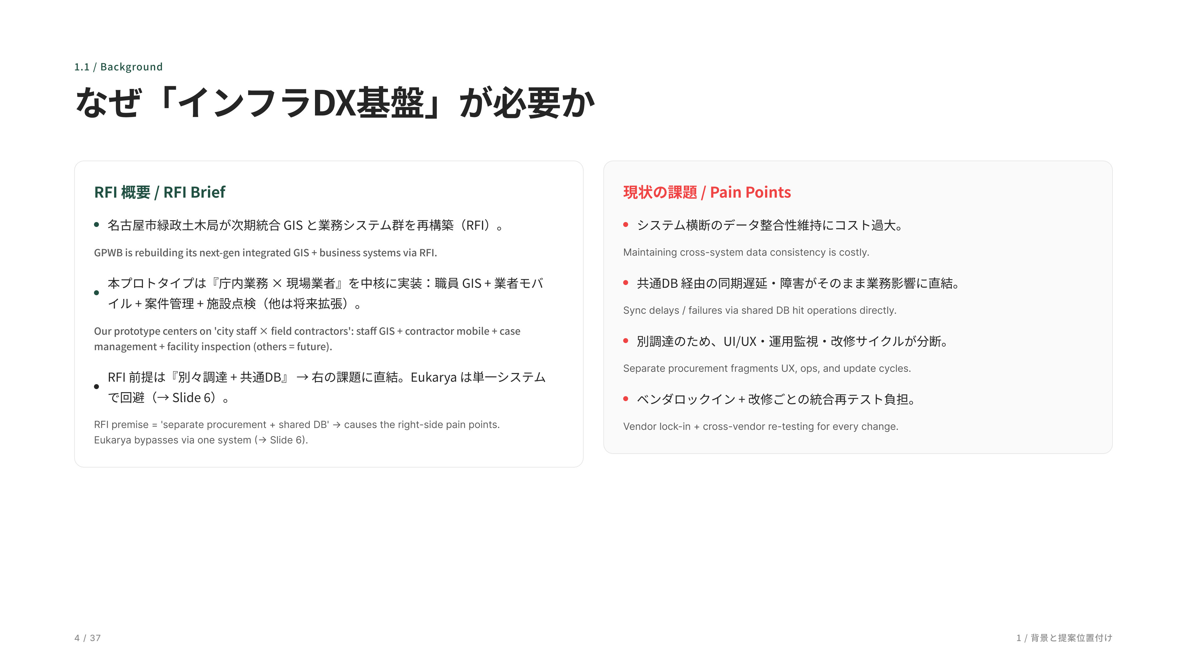
This section outlines the RFI background and current challenges. The Nagoya City RFI assumes an architecture where multiple vendors are connected through a shared database. However, this approach introduces structural issues such as data consistency costs, synchronization delays, fragmented user experiences and operations, and vendor lock-in. Our approach avoids these challenges at the architectural level by unifying municipal staff and field contractors within a single integrated system.
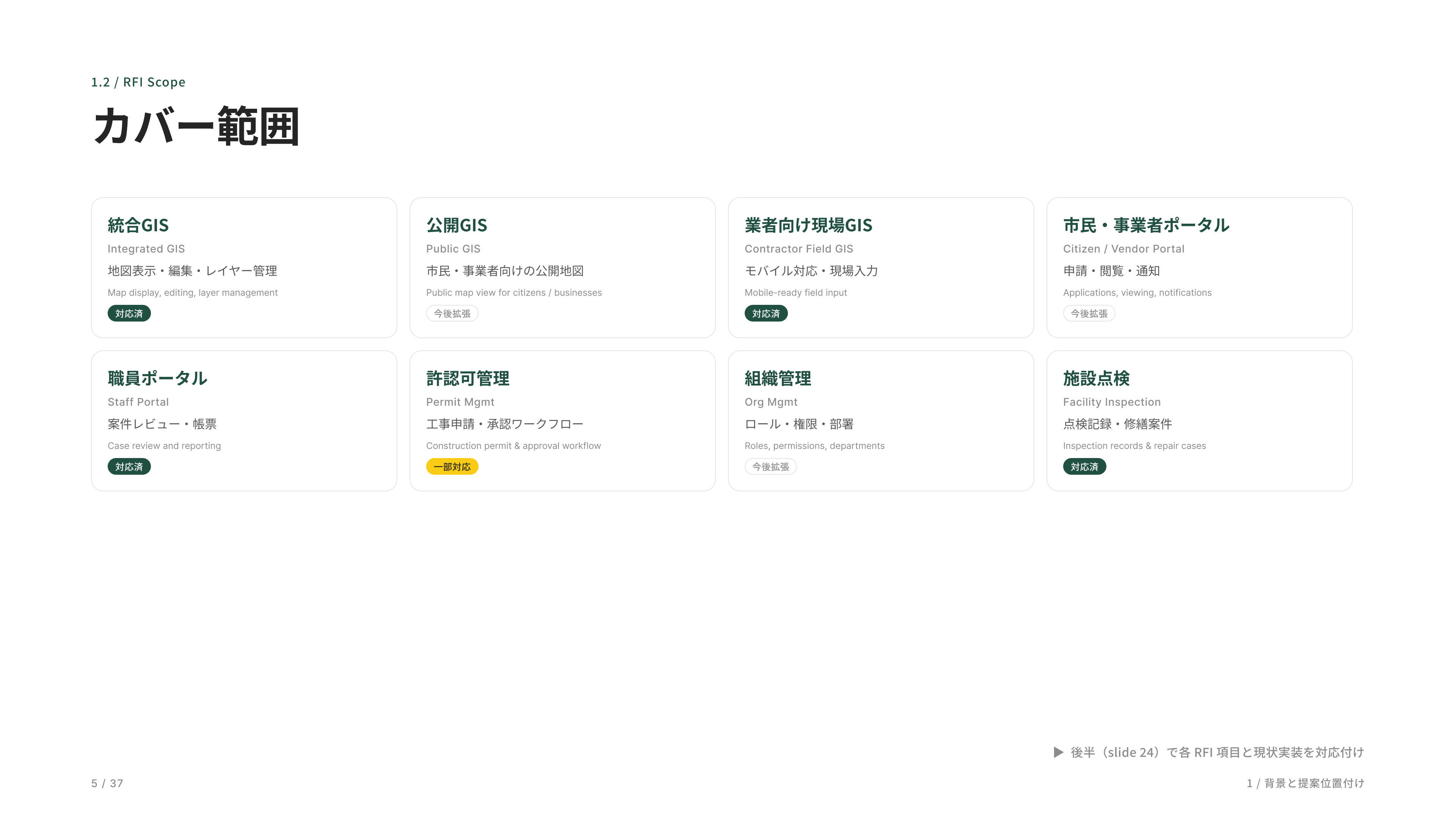
This slide summarizes the eight domains defined in the RFI. Status badges indicate the implementation level for each area: green represents fully supported capabilities, yellow indicates partial support, and gray marks areas planned for future expansion.
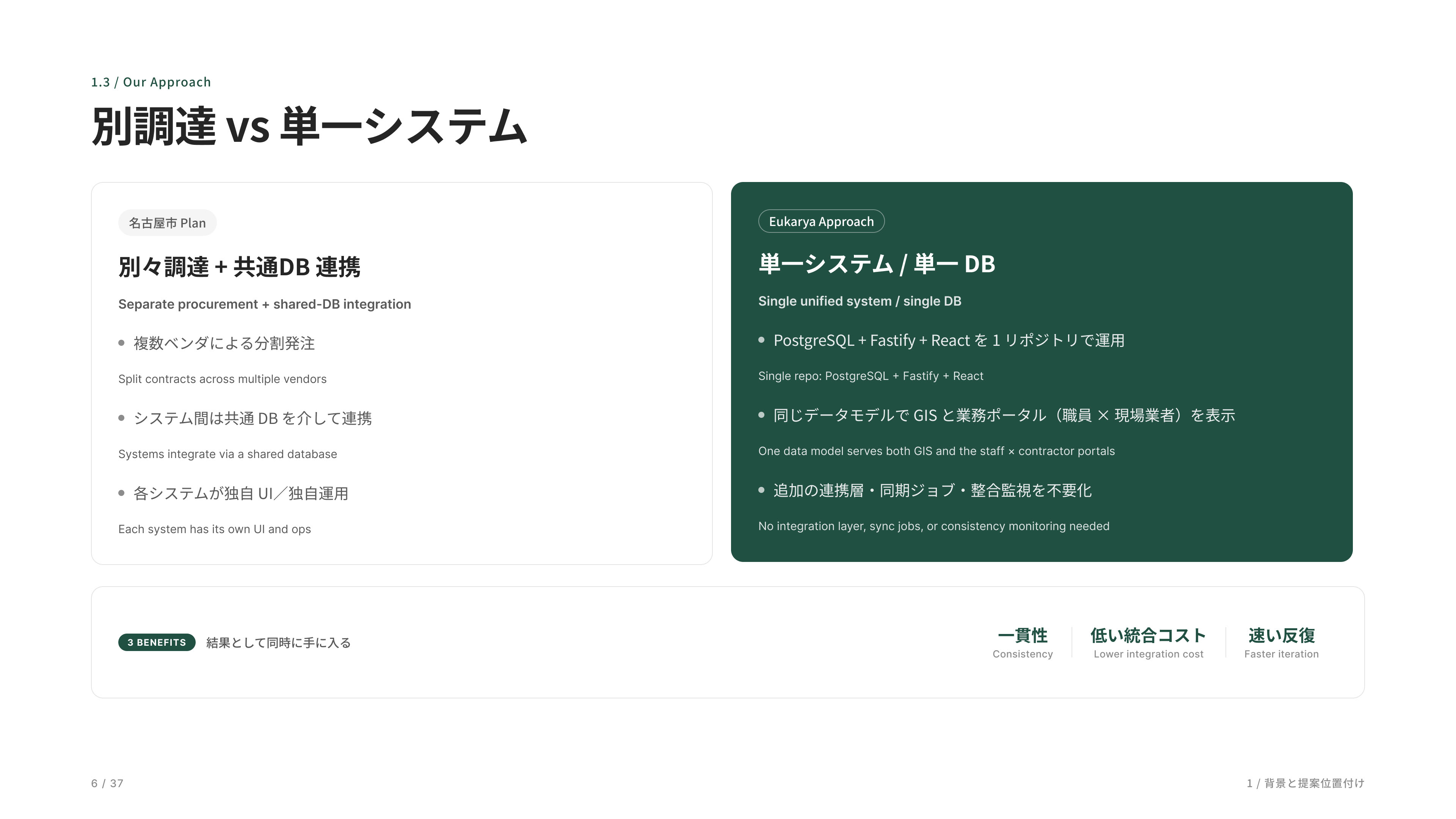
This is the core of the solution. The left side illustrates the separated procurement model assumed by the RFI, while the right side shows our integrated approach. The three key benefits are consistency, lower integration costs, and faster iteration—all enabled through a single unified system.
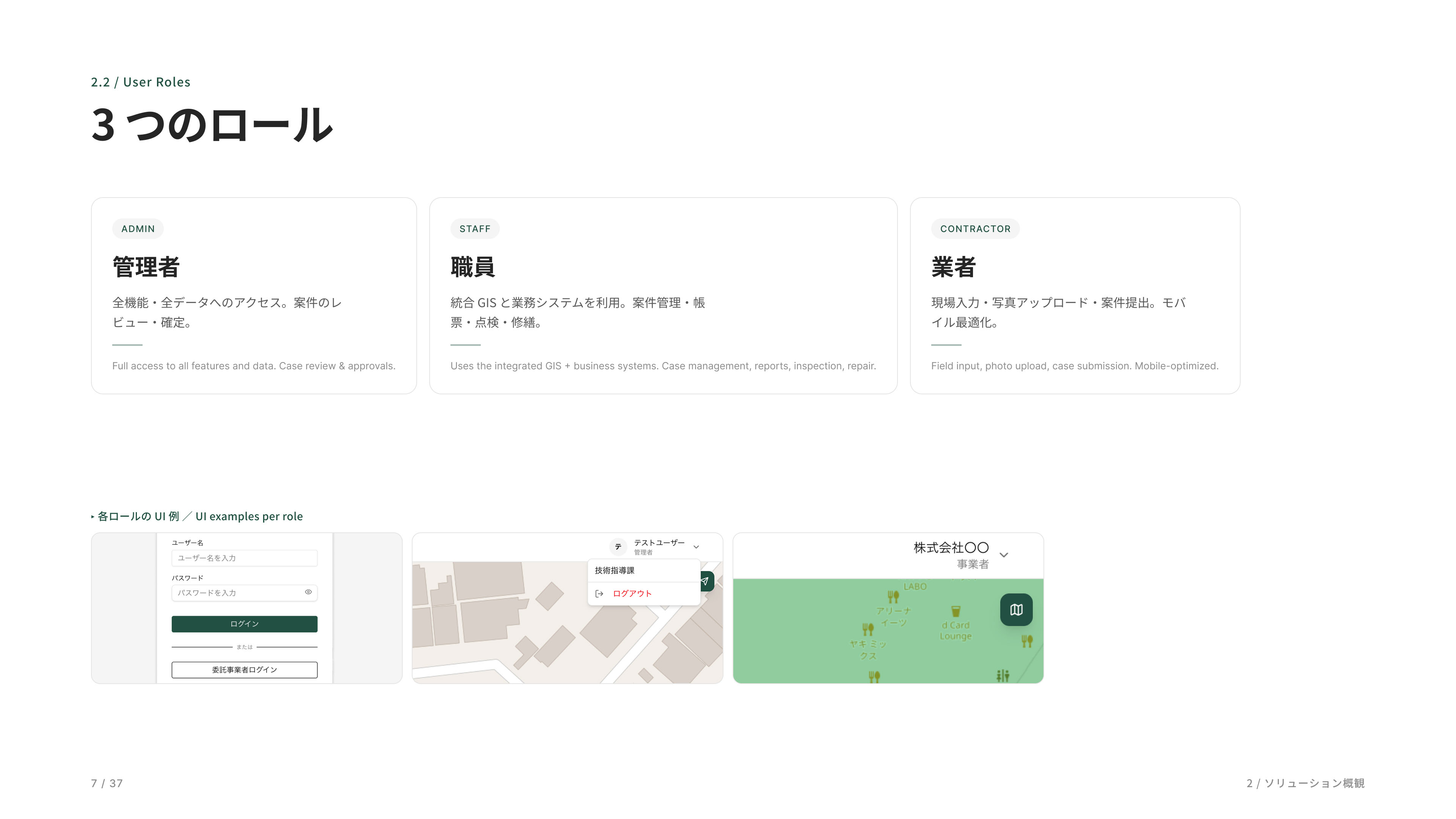
The system currently supports three roles: administrators, municipal staff, and contractors. A public-facing citizen portal has not yet been implemented; however, a Delivery API is available to expose data to external services when needed.
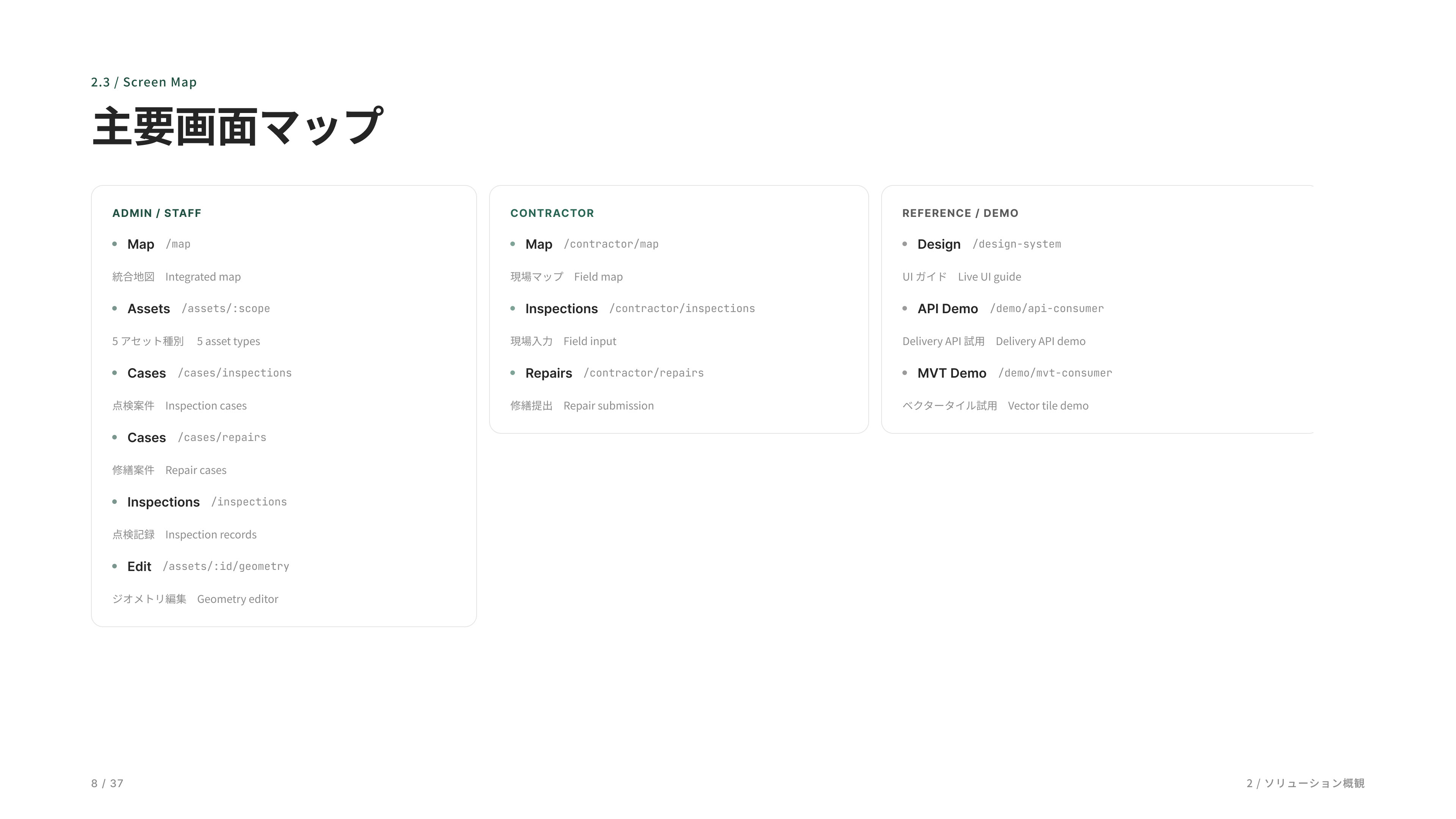
This is the overall screen map of the platform, organized into three groups: Administrator & Staff, Contractor, and Reference & Demo.
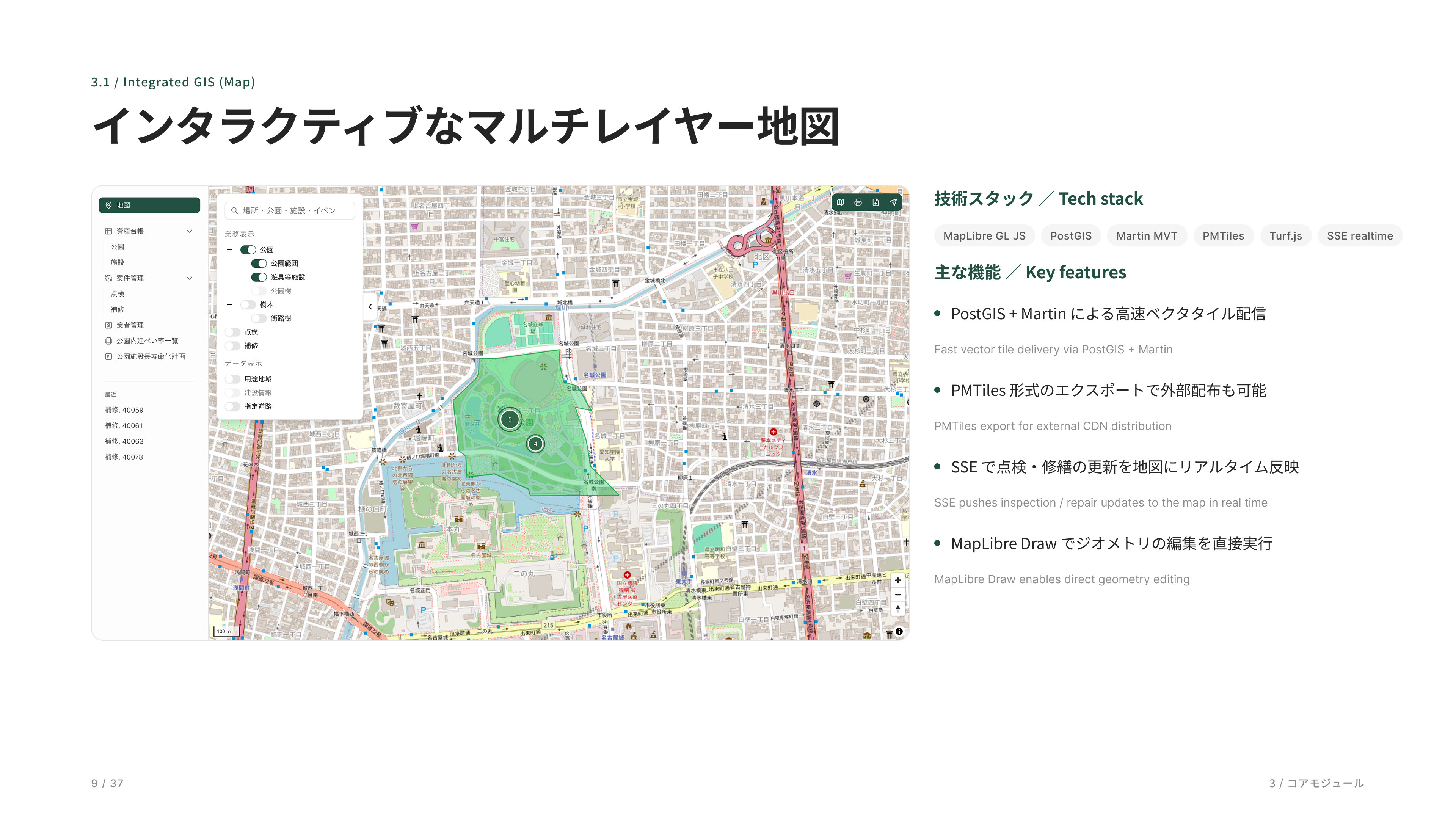
This is the main GIS interface. Built on MapLibre and PostGIS, it provides a real-time view of parks, facilities, inspections, and maintenance activities, with updates immediately reflected on the map as work progresses.
This integrated map brings urban infrastructure into a single view. As users zoom into an area of interest, individual facilities appear as map pins, allowing photos, specifications, and asset details to be accessed directly with a click.
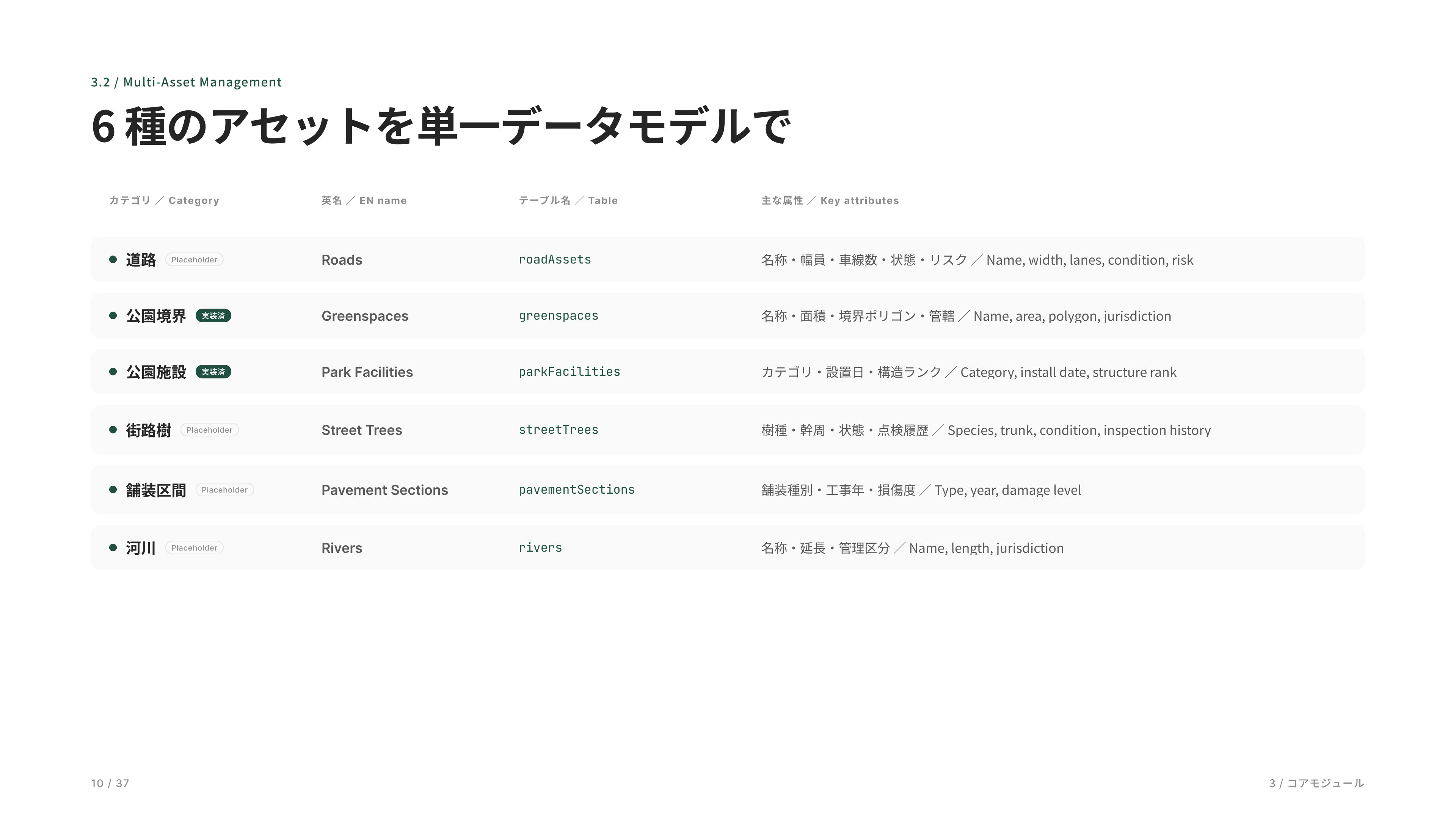
The schema defines six asset types. The current prototype implements two of them—park boundaries and park facilities. The remaining asset categories—roads, street trees, pavement segments, and rivers—are already modeled in the data structure and can be added using the same framework when needed. Inspections and maintenance records are linked to all asset types through a common workflow pattern.
Asset registry for park infrastructure. Users can instantly filter records through search, and open detailed asset information directly from the list view with a single click.
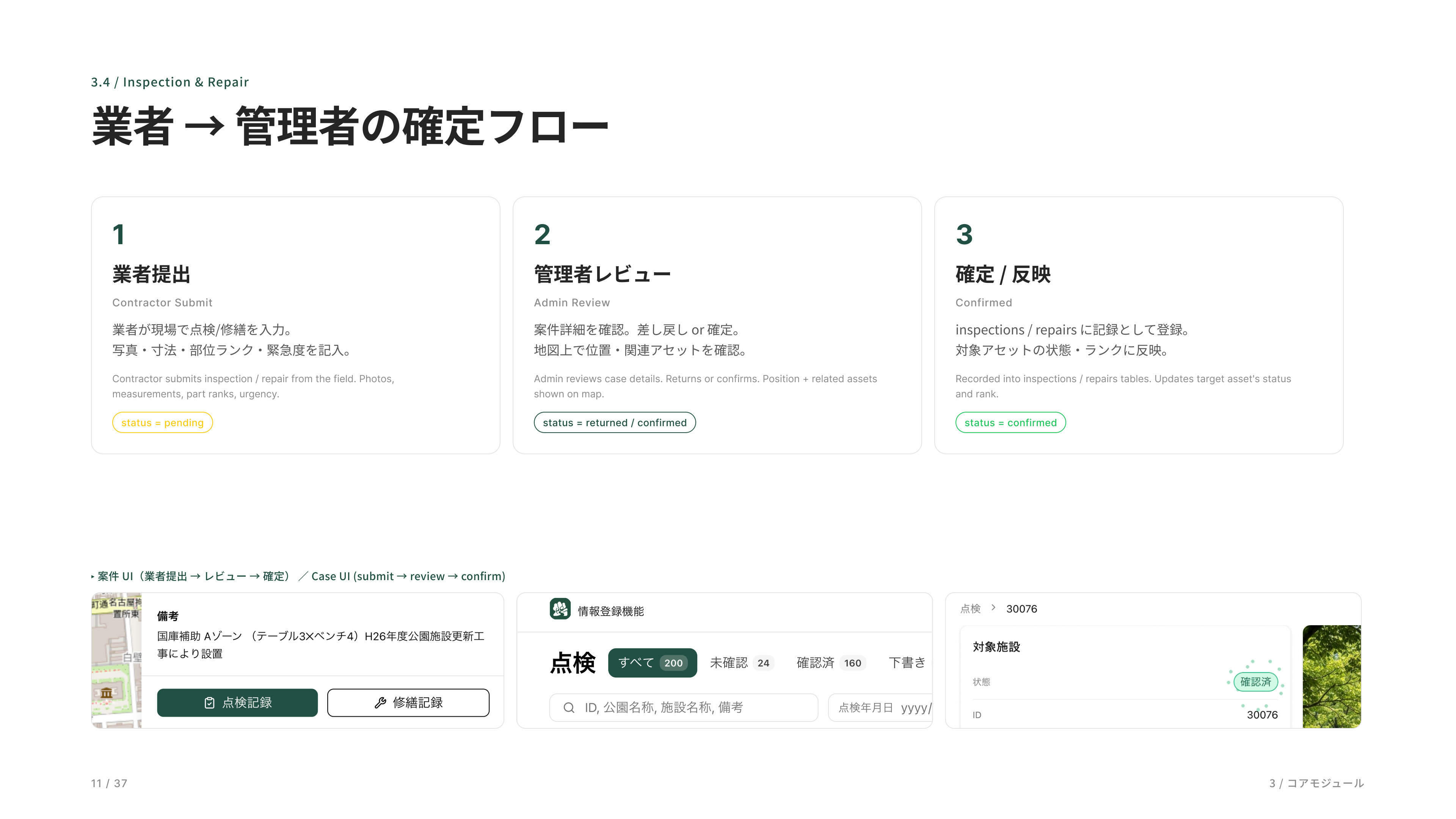
This is the work order management workflow. Contractors submit inspection results from the field with photos, administrators review the submission, and approved records are finalized through a simple three-step process. Priority and component condition ratings enable efficient triage and maintenance planning.
This is the list view for park assets and inspection work orders. Users can search and filter asset records such as parks and facilities, while inspection cases can be narrowed by review status, priority level, and resolution status. The interface provides quick access to relevant assets and work orders, enabling more efficient day-to-day maintenance operations and progress tracking.
This is the work order detail view. Inspection cases follow a contractor submission → administrator review → final approval workflow. Administrators can review the associated asset and inspection results, then mark the case as completed with a single confirmation action.
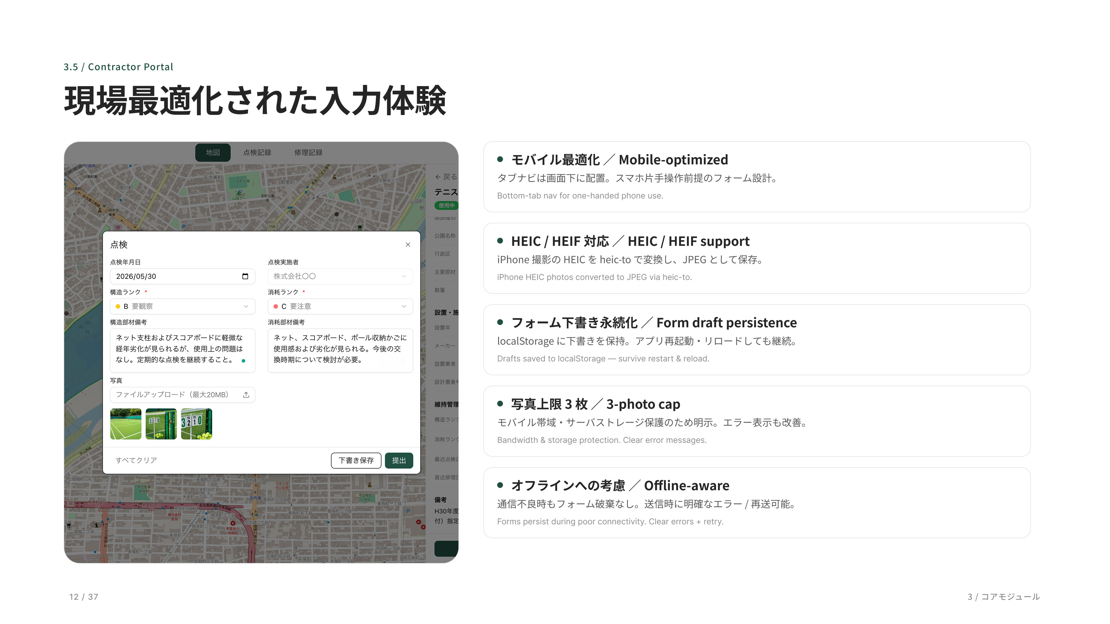
The contractor portal is optimized for mobile use in the field. It supports HEIC photo uploads, draft saving for partially completed forms, and a three-photo upload limit, reflecting the practical constraints and workflows of on-site operations.
Mobile interface for field contractors. Contractors can open assigned inspections from a task list, record condition assessments, attach photos, and submit results directly from a tablet. The entire inspection workflow can be completed on-site in a single streamlined process.
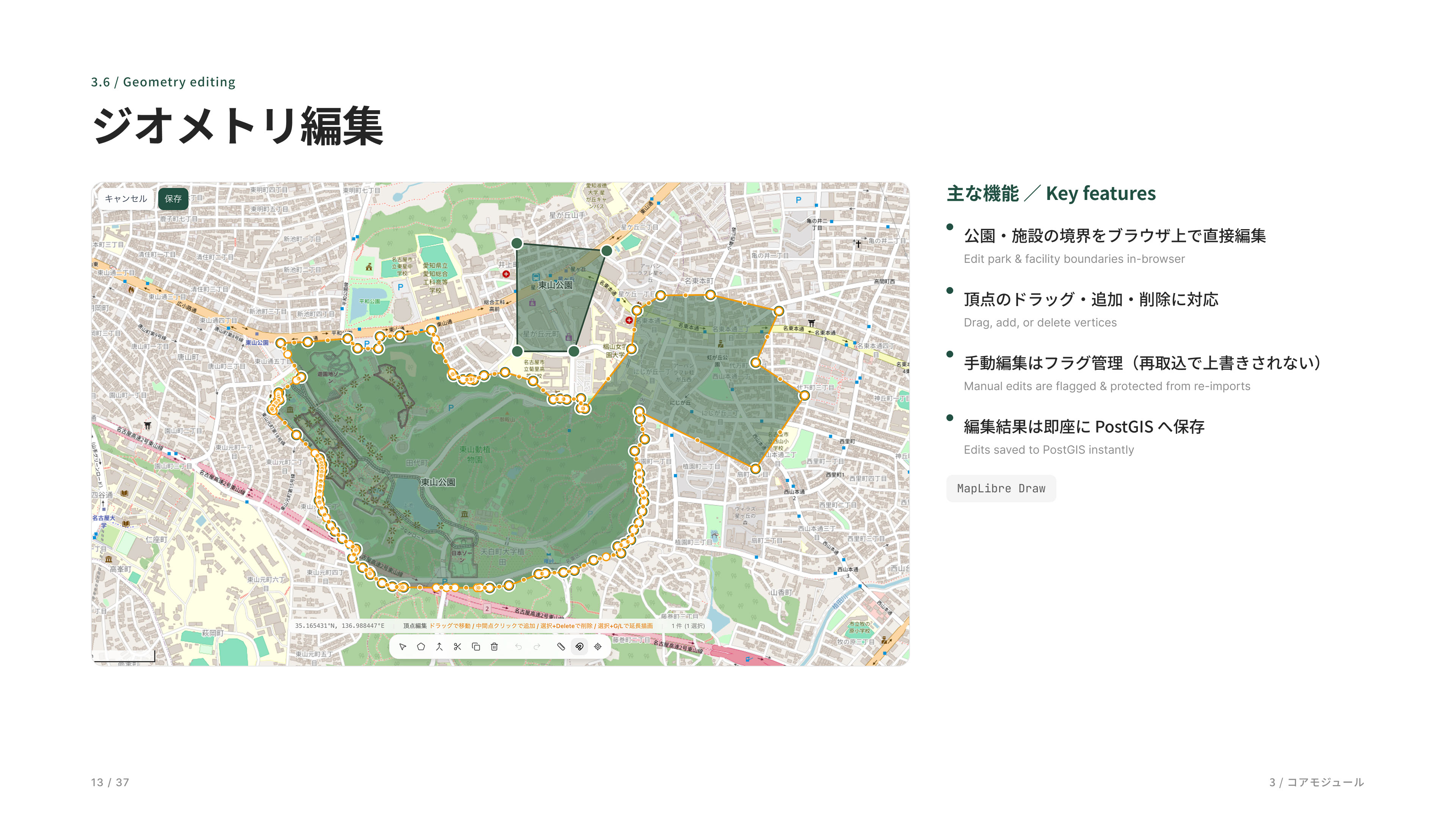
This feature allows park and facility boundaries to be edited directly in the browser. Using MapLibre Draw, users can drag, add, or remove vertices, with changes immediately persisted to PostGIS. Manually edited geometries are protected by a dedicated flag, ensuring they are not overwritten during future external data imports.
This screen is used to edit park boundaries. Users can adjust existing shapes by dragging vertices, draw and merge new areas into the park geometry, and then save the updated boundary with a single action.
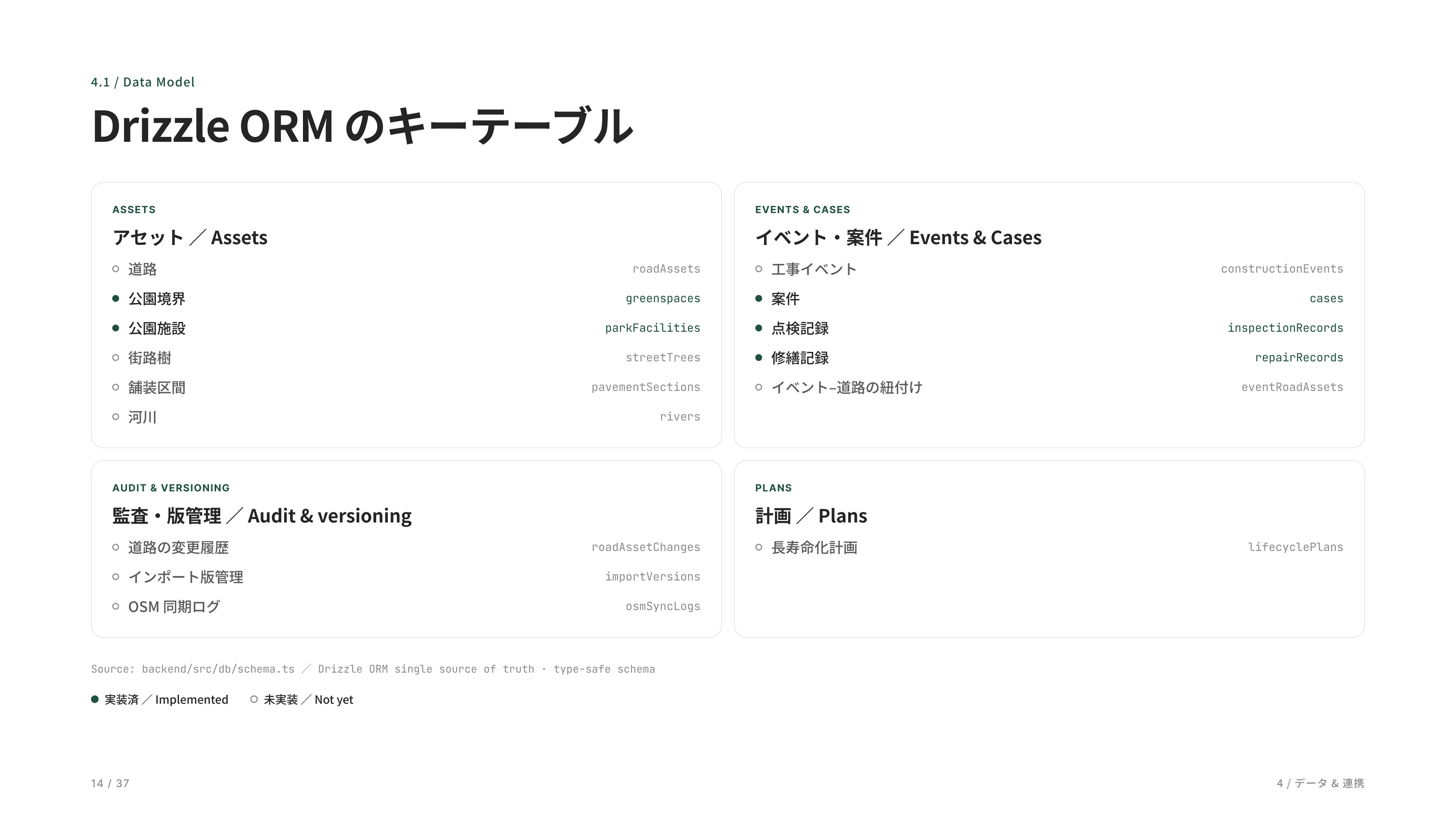
This diagram shows the primary database tables. Green indicates tables that are fully implemented in the current prototype, while gray represents schemas that have been defined but are not yet implemented. The implemented tables include park boundaries and park facilities (asset management), as well as cases, inspection records, and maintenance records (work management). Schemas for roads, street trees, pavement segments, rivers, construction events, version management, and OSM synchronization are already in place and can be implemented as future extensions.
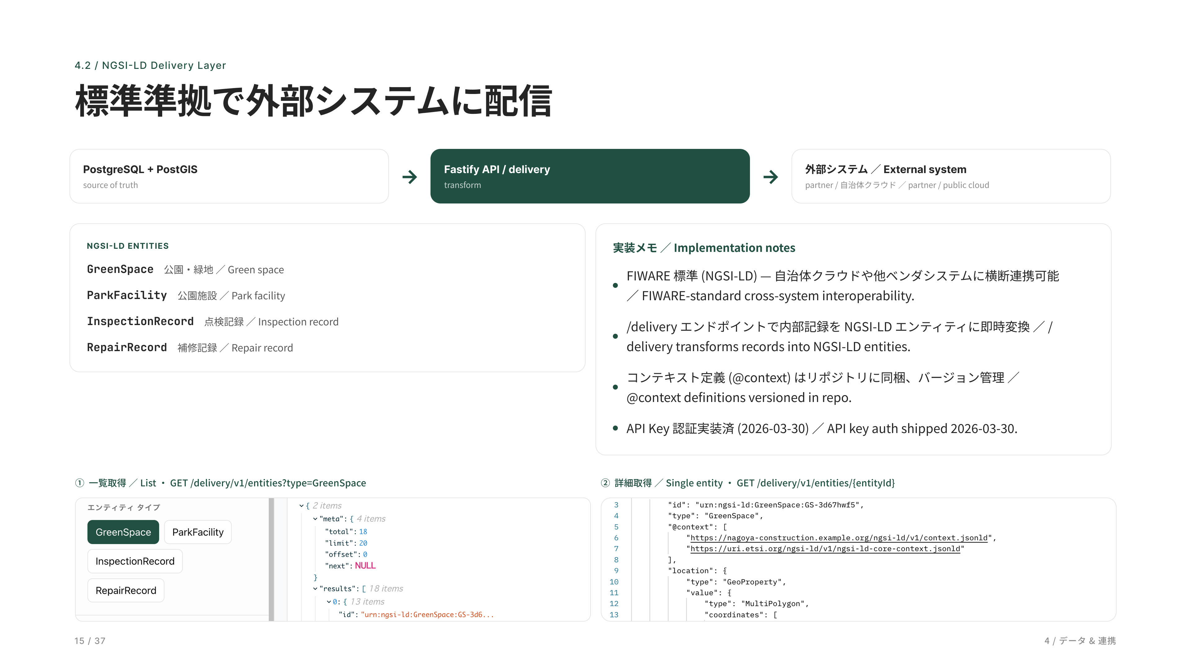
This is the integration layer for external systems. By conforming to the FIWARE NGSI-LD standard, the platform can interoperate with municipal cloud environments and third-party vendor systems through a standardized data model and API framework.
This area implements data delivery through the Delivery API. Park and facility information can be published to external systems using NGSI-LD and OGC standards, with support for standardized queries, record counts, and pagination. A public-facing citizen portal is not included in the current prototype.
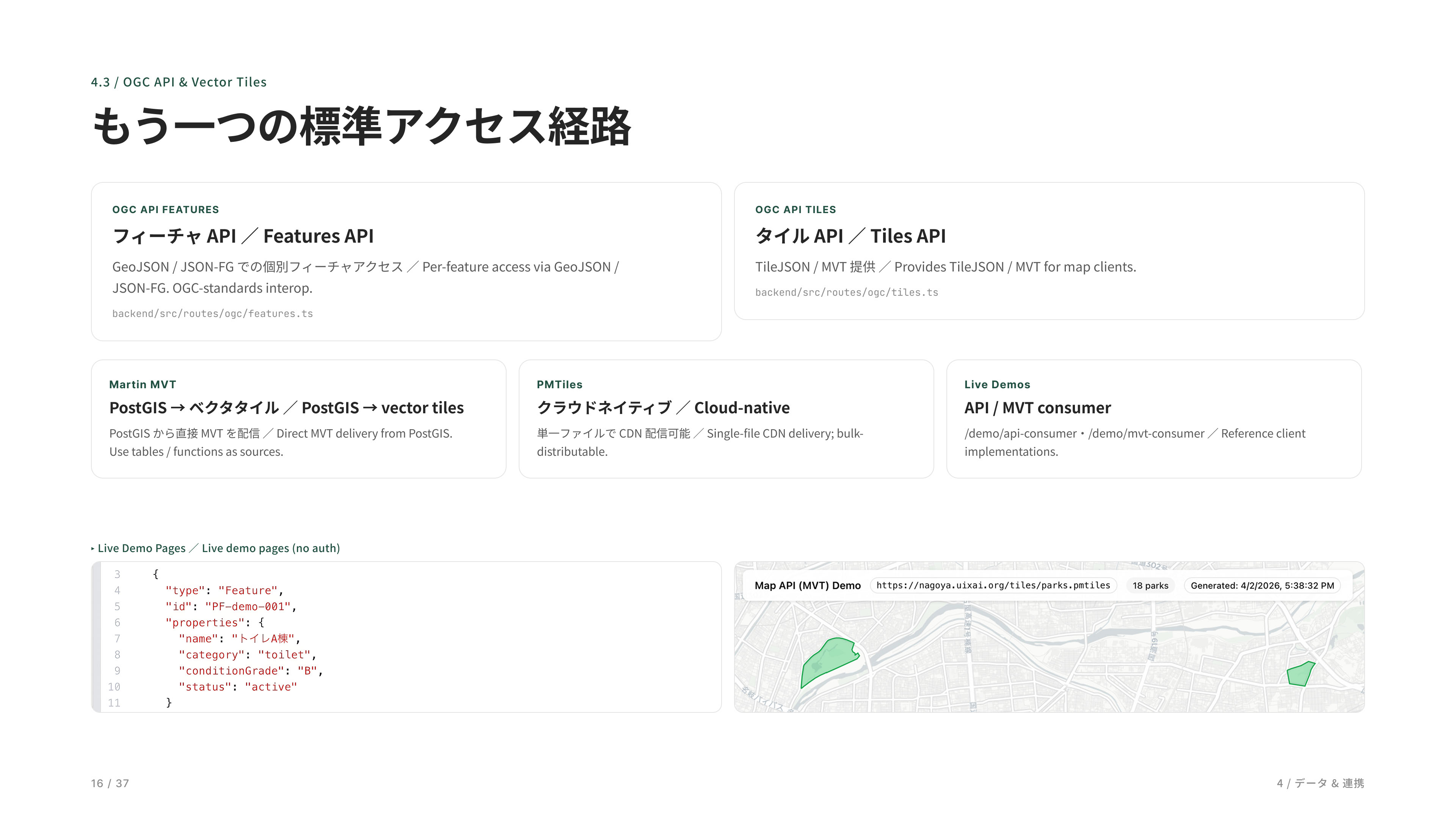
This demo showcases OGC API–compliant data delivery. Park and facility data can be accessed as GeoJSON or vector tiles for map visualization and integration with external systems. Tile data is generated directly from PostGIS, while PMTiles enables a cloud-native distribution model. By supporting both NGSI-LD and OGC international standards, the platform provides a high level of interoperability, allowing data to be consumed directly by third-party systems and widely used GIS tools.
This API delivers geospatial data using international standards. Users can browse available datasets and retrieve geographic features directly, enabling straightforward integration with other systems through a standards-based interface.
This demo delivers park data as vector tiles (MVT / PMTiles), enabling lightweight and high-performance map rendering. Park polygons remain crisp and responsive even when zooming into the city. By clicking a park, users can view feature attributes such as its name, ID, category, and district, while the corresponding tile service endpoint is also displayed for reference.
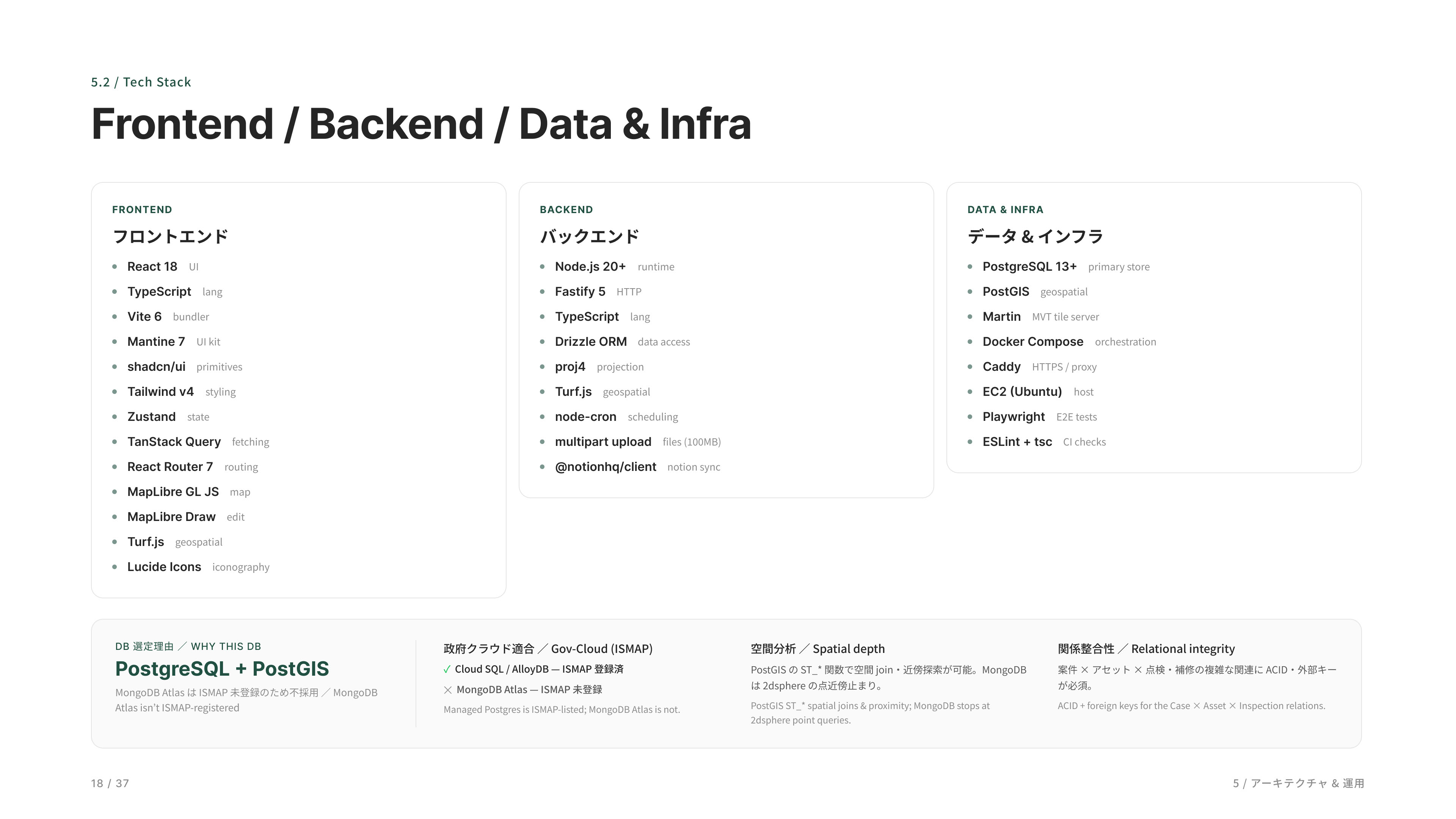
This slide summarizes the technologies used in the prototype, organized into three layers: frontend, backend, and data & infrastructure.
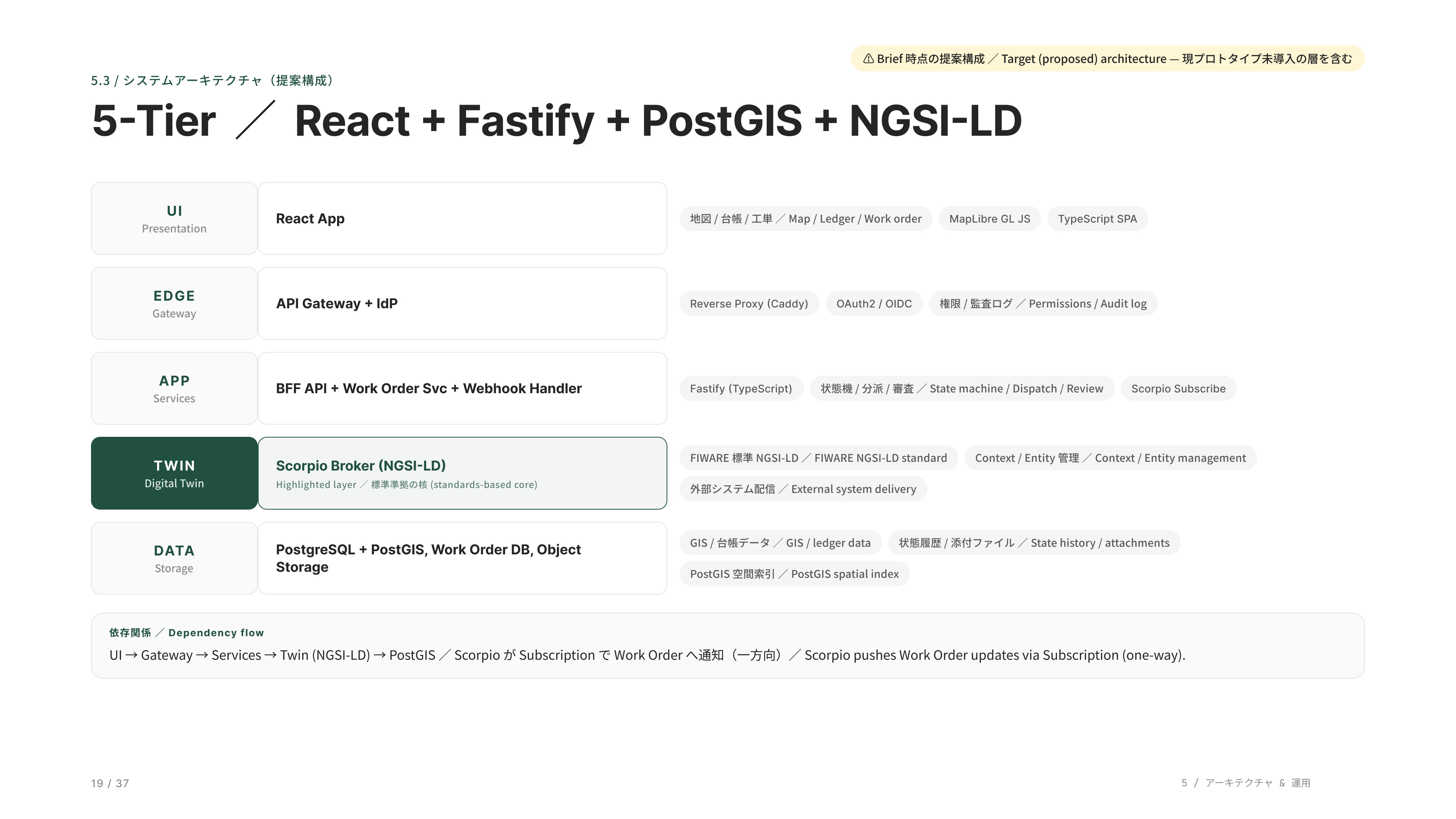
This diagram illustrates the target architecture proposed in the Brief: a five-layer stack with an NGSI-LD broker, such as FIWARE Scorpio or Orion-LD, serving as the Digital Twin layer. The current prototype takes a simpler approach—without a broker—where the Fastify-based Delivery API transforms data directly from PostgreSQL into NGSI-LD format for external distribution.
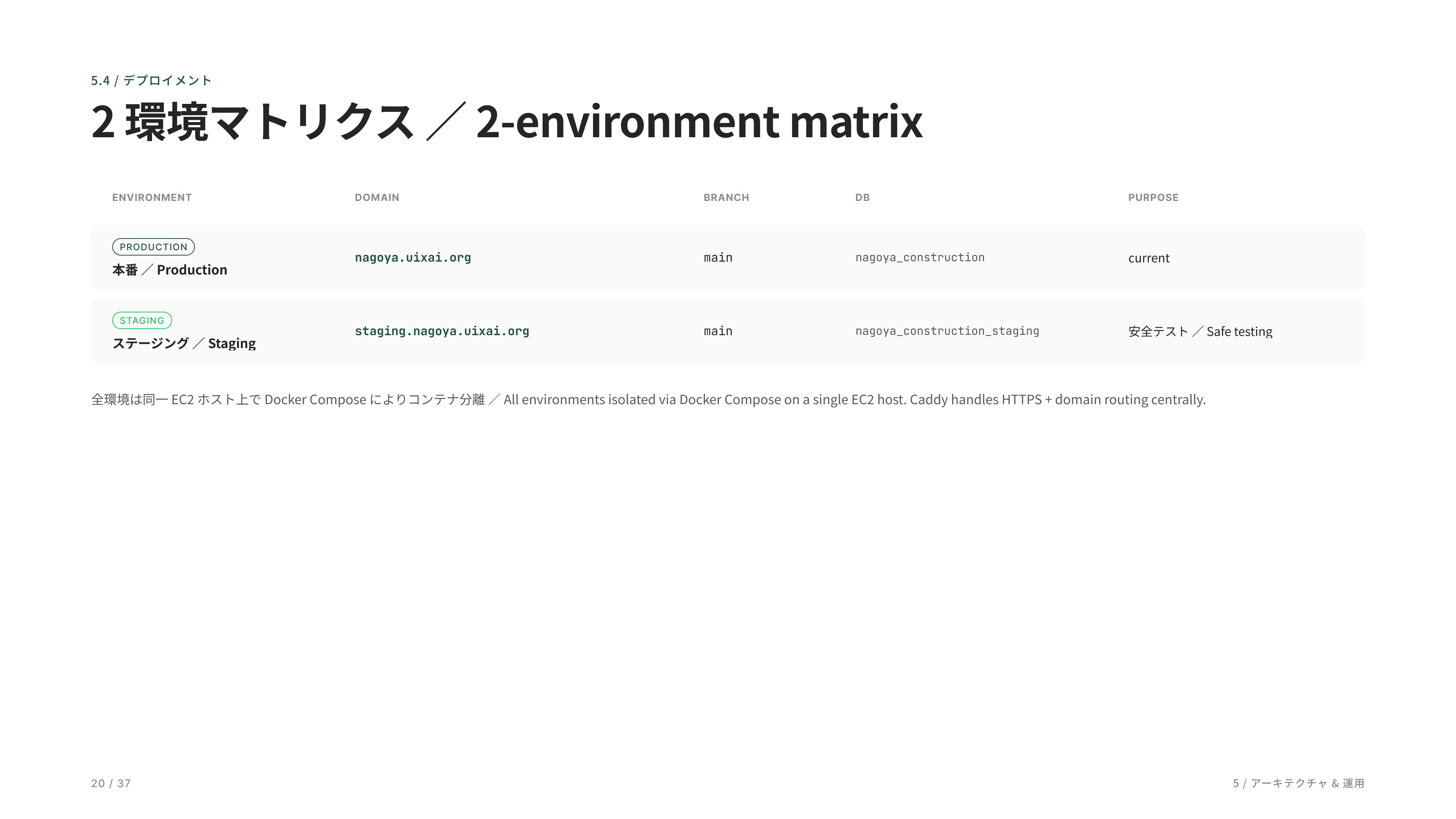
The deployment environment consists of two isolated instances running on the same server through separate containers. This allows new features and changes to be validated in staging while keeping the production environment stable and unchanged.
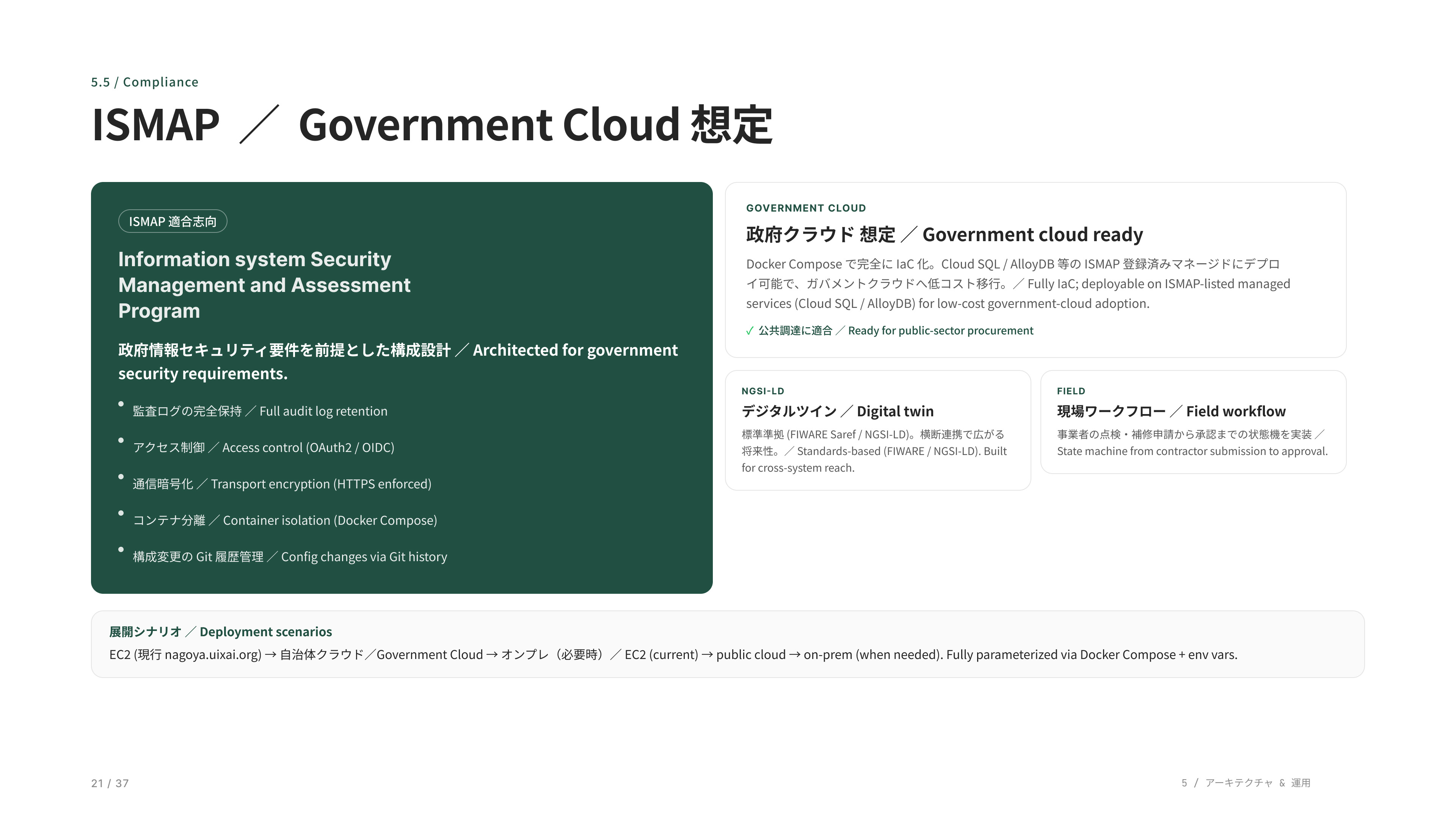
Government cloud readiness. The platform is designed with ISMAP-aligned practices in mind, including audit logging and access control as standard capabilities. Its containerized Docker-based architecture also enables straightforward deployment and portability across government cloud environments.
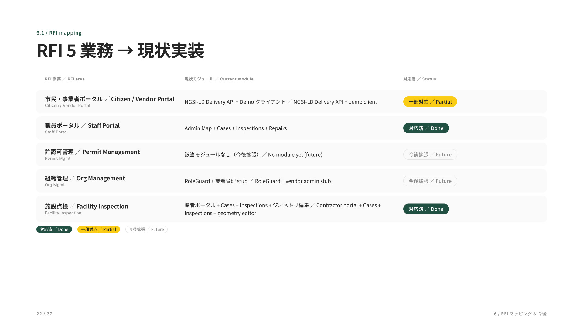
This table maps the prototype against the five operational areas defined in the RFI. The Staff Portal and Facility Inspection functions are fully implemented, the Citizen Portal is partially supported through the Delivery API, and Permitting and Organization Management are planned for future expansion.
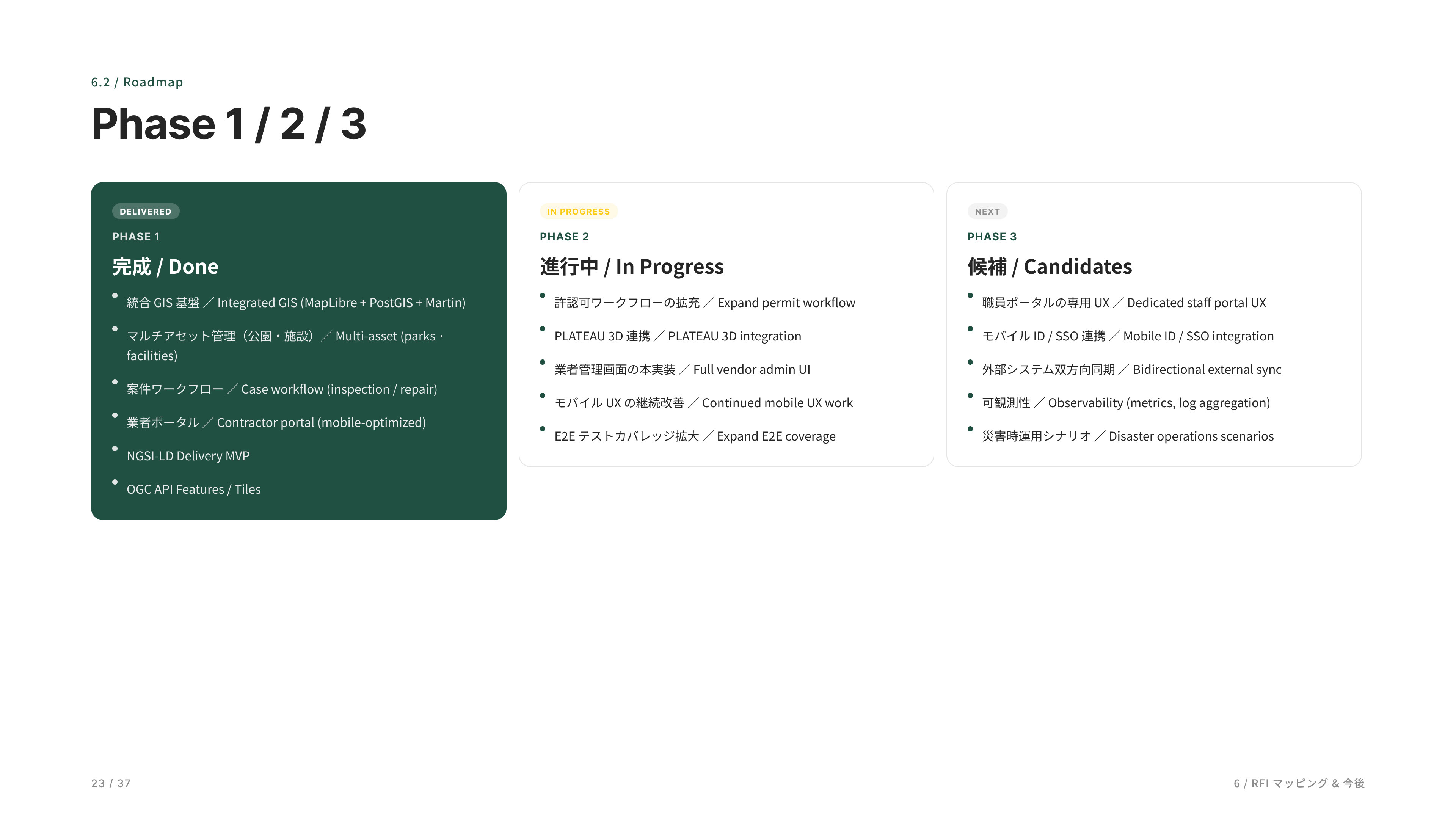
This roadmap outlines the project phases. Phase 1 has been completed and is currently operational, Phase 2 is actively in progress, and Phase 3 represents future expansion opportunities under consideration.
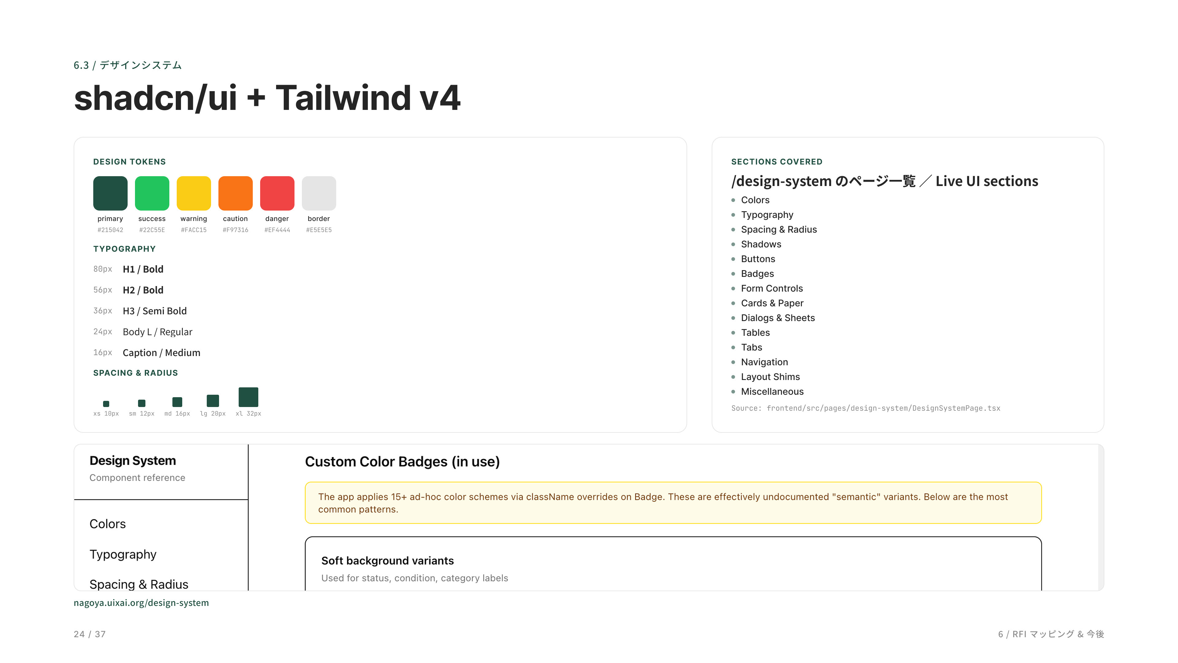
This is the design system used across the platform. It is built with Tailwind CSS and shadcn/ui, and a live implementation can be explored through the /design-system showcase.
Live Design System view. The /design-system page showcases all 14 component sections used across the application. It provides a browser-based catalog of the actual colors, typography, buttons, tables, and UI components used in production, allowing teams to interact with them directly and ensure design and implementation remain consistently aligned.
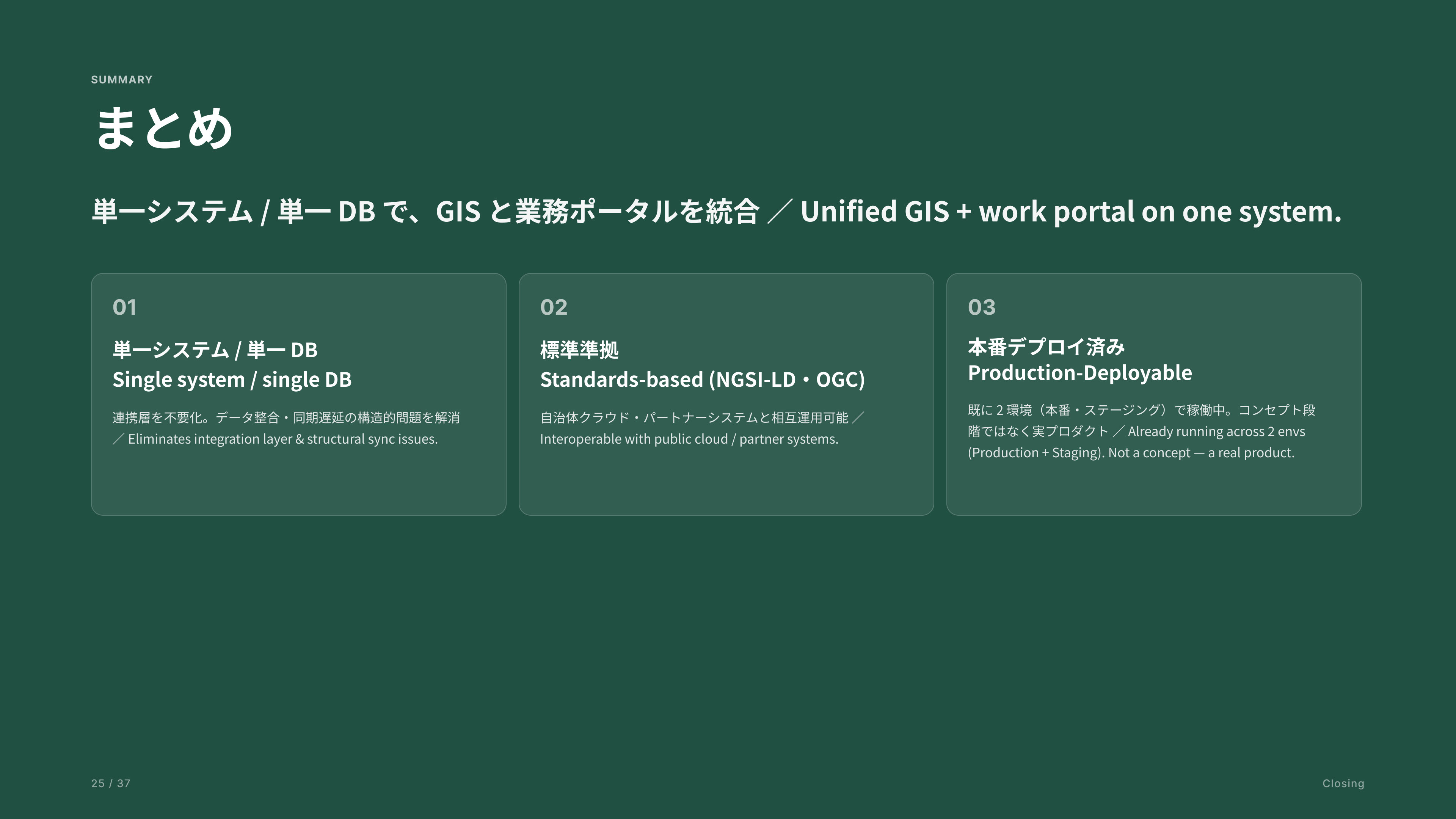
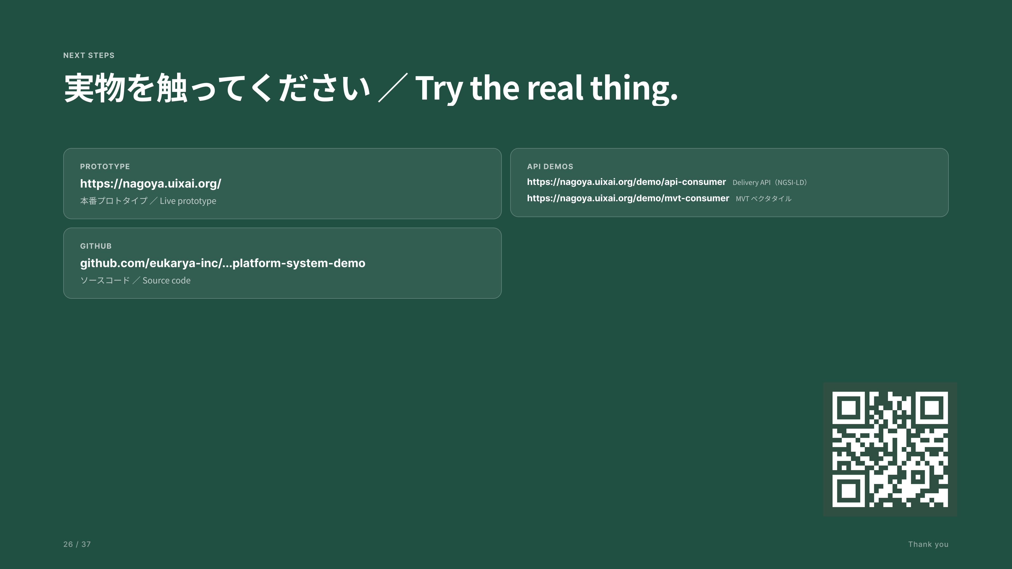
In summary, the solution is differentiated by three key strengths: a unified single-system architecture, compliance with open standards such as NGSI-LD and OGC, and proven operation across four deployed environments.